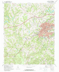
1971 Map of Gaffney
USGS Topo · Published 1988About this map
The textile-rich economy of Gaffney is evident in this early 1970s survey, showing the city's concentrated growth around the Southern Railway corridor. The campus of Limestone College serves as a major eastern anchor for the community, situated near the historically significant Limestone Springs. Rural life in Cherokee County is documented through numerous country churches and schools that serve outlying areas, such as Mt Sinai Ch and the Beaverdam Ch.
Find a feature on this map
70 named features on this map. Tap any name to fly to it.
Don’t see what you’re looking for? This feature index may not catch every label — zoom into the map to look around manually.
Map Details
Editions of this 1971 Gaffney Map
2 editions found
Other maps of this area

1909 · Gaffney
USGS Topo · 1:62,500

1941 · Spartanburg
USGS Topo · 1:250,000

1947 · Spartanburg
USGS Topo · 1:62,500

1949 · Spartanburg
USGS Topo · 1:62,500

1953 · Spartanburg
USGS Topo · 1:250,000

1953 · Charlotte
USGS Topo · 1:250,000

1954 · Charlotte
USGS Topo · 1:250,000

1959 · Cowpens
USGS Topo · 1:62,500

1960 · Charlotte
USGS Topo · 1:250,000

1960 · Spartanburg
USGS Topo · 1:250,000