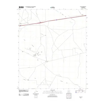
2010 Map of Gage
USGS Topo · Published 2010About this map
Mining operations and cattle ranching define this high-desert landscape in the Victorio Mountains region. At the settlement of Gage, the modern interstate corridor parallels historic transit routes, while the surrounding flats are dotted with essential water infrastructure like Separ Windmill and Airington Windmill. The map reveals a dense concentration of mineral claims to the west, including the Rambler Mine, Excess Mine, and the Chance and Jessie Mines. These sites, along with the Victorio Group and Tedford Prospect, highlight the area's geological significance for prospectors. To the east, the drainage of Walnut Creek and Cow Springs Draw provide topographic structure to the open terrain near Earp Ranch, illustrating how water sources dictated the placement of early New Mexico settlements.
Find a feature on this map
31 named features on this map. Tap any name to fly to it.
Don’t see what you’re looking for? This feature index may not catch every label — zoom into the map to look around manually.
Map Details
Editions of this 2010 Gage Map
This is the sole edition of this map. No revisions or reprints were ever made.
Other maps of this area

1899 · Deming
USGS Topo · 1:125,000

1915 · Deming
USGS Topo · 1:125,000

1954 · Silver City
USGS Topo · 1:250,000

1955 · Las Cruces
USGS Topo · 1:250,000

1958 · Las Cruces
USGS Topo · 1:250,000

1958 · Silver City
USGS Topo · 1:250,000

1962 · Silver City
USGS Topo · 1:250,000

1963 · Gage SW
USGS Topo · 1:24,000

1963 · Gage NW
USGS Topo · 1:24,000

1963 · Gage
USGS Topo · 1:24,000