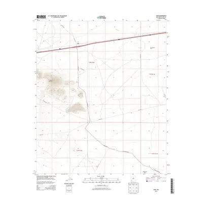
2013 Map of Gage
USGS Topo · Published 2013About this map
Victoria Mountains dominate the western landscape of this high-desert region, where the terrain transitions into the broad basins of southern Luna County. The settlement of Gage serves as a central point along the primary transportation corridor, marked by a network of county roads like CO Road C004 and CO Road C020 that connect isolated outposts such as Williams Ranch. The map captures a landscape defined by ephemeral hydrology and ranching infrastructure, evidenced by Walnut Cr, Cow Springs Draw, and the CCC Tank located in the southeastern section. This 2013 survey provides a detailed look at the rural infrastructure of the region, including the prominent Pipeline Rd and Gage Station Rd SW, which navigate the wide draws like Seventysix Draw in an area primarily organized by the Public Land Survey System township and range divisions.
Find a feature on this map
20 named features on this map. Tap any name to fly to it.
Don’t see what you’re looking for? This feature index may not catch every label — zoom into the map to look around manually.
Map Details
Editions of this 2013 Gage Map
This is the sole edition of this map. No revisions or reprints were ever made.
Other maps of this area

1899 · Deming
USGS Topo · 1:125,000

1915 · Deming
USGS Topo · 1:125,000

1954 · Silver City
USGS Topo · 1:250,000

1955 · Las Cruces
USGS Topo · 1:250,000

1958 · Las Cruces
USGS Topo · 1:250,000

1958 · Silver City
USGS Topo · 1:250,000

1962 · Silver City
USGS Topo · 1:250,000

1963 · Gage SW
USGS Topo · 1:24,000

1963 · Gage NW
USGS Topo · 1:24,000

1963 · Gage
USGS Topo · 1:24,000