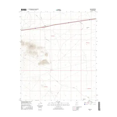
2017 Map of Gage
USGS Topo · Published 2017About this map
Victorio Mountains rise prominently in the western portion of this high-desert landscape, a stark contrast to the surrounding alluvial plains of Luna County. The small settlement of Gage serves as a key waypoint along the corridor shared by Interstate 10 and U.S. Route 70, tracing a historic path of transcontinental transit. This 2017 survey details a network of ranching and access roads, including Phillips Ranch Rd and Casa Blanca Rd Sw, which crisscross the arid terrain toward water features like Walnut Cr and Cow Springs Draw. The inclusion of the CCC Tank in the southeast quadrant reflects the lasting impact of early 20th-century water management infrastructure in the American Southwest, where such landmarks remain vital markers for navigation and land use.
Find a feature on this map
19 named features on this map. Tap any name to fly to it.
Don’t see what you’re looking for? This feature index may not catch every label — zoom into the map to look around manually.
Map Details
Editions of this 2017 Gage Map
This is the sole edition of this map. No revisions or reprints were ever made.
Other maps of this area

1899 · Deming
USGS Topo · 1:125,000

1915 · Deming
USGS Topo · 1:125,000

1954 · Silver City
USGS Topo · 1:250,000

1955 · Las Cruces
USGS Topo · 1:250,000

1958 · Las Cruces
USGS Topo · 1:250,000

1958 · Silver City
USGS Topo · 1:250,000

1962 · Silver City
USGS Topo · 1:250,000

1963 · Gage SW
USGS Topo · 1:24,000

1963 · Gage NW
USGS Topo · 1:24,000

1963 · Gage
USGS Topo · 1:24,000