
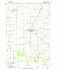
1963 Map of Gagetown
USGS Topo · Published 1964About this map
Gagetown sits at the intersection of agricultural and industrial history in this mid-century survey of the Huron Co Tuscola Co line. The village is a hub for the Grand Trunk Western RR, while the surrounding landscape is defined by an extensive network of man-made drainage systems like Cooley Drain and Rescue Drain that supported the local farming economy. Small settlements such as Bach and Rescue appear alongside rural landmarks, including Canboro Sch and Greenwood Sch. The map reveals the gradual evolution of transport, marking both the active rail lines and an Old RR Grade in the south near the Elkland Cemetery. Natural features like the Pigeon River and Mud Lake persist amidst a grid of section roads named for local families, such as Maxwell Road and Moore Road.
Find a feature on this map
71 named features on this map. Tap any name to fly to it.
Don’t see what you’re looking for? This feature index may not catch every label — zoom into the map to look around manually.
Map Details
Editions of this 1963 Gagetown Map
This is the sole edition of this map. No revisions or reprints were ever made.
Other maps of this area

1954 · Flint
USGS Topo · 1:250,000

1958 · Flint
USGS Topo · 1:250,000

1963 · New Greenleaf
USGS Topo · 1:24,000

1963 · Cass City
USGS Topo · 1:24,000

1963 · Ellington
USGS Topo · 1:24,000

1963 · Shabbona
USGS Topo · 1:24,000

1963 · Owendale
USGS Topo · 1:24,000

1970 · Bay Port East
USGS Topo · 1:24,000

1970 · Bad Axe West
USGS Topo · 1:24,000
1970 · Elkton
USGS Topo · 1:24,000