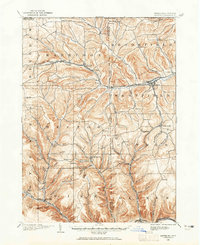
1899 Map of Gaines
USGS Topo · Published 1965About this map
Harrison Valley and Westfield serve as the primary hubs in this late nineteenth-century portrait of northern Pennsylvania. The Cowanesque River corridor dictates the movement of commerce, paralleled by the New York Central and Hudson River RR, which connects industrial points like Tannery and Elmer. To the south, the Buffalo and Susquehanna RR follows the winding path of Pine Creek, illustrating how deeply the timber and rail industries influenced the settlement patterns of Potter and Tioga Counties.
Find a feature on this map
78 named features on this map. Tap any name to fly to it.
Don’t see what you’re looking for? This feature index may not catch every label — zoom into the map to look around manually.
Map Details
Editions of this 1899 Gaines Map
2 editions found
Other maps of this area

1899 · Gaines
USGS Topo · 1:62,500

1900 · Gaines
USGS Topo · 1:62,500

1900 · Elkland
USGS Topo · 1:62,500

1924 · Woodhull
USGS Topo · 1:48,000

1926 · Wellsville
USGS Topo · 1:62,500

1926 · Woodhull
USGS Topo · 1:62,500

1926 · Greenwood
USGS Topo · 1:62,500

1932 · Genesee
USGS Topo · 1:62,500

1937 · Genesee
USGS Topo · 1:62,500

1944 · Woodhull
USGS Topo · 1:62,500