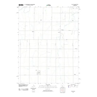
2009 Map of Galatia
USGS Topo · Published 2009About this map
Galatia and its surrounding agricultural grid define this Central Kansas landscape as it appeared in the early 21st century. The map reveals a region where energy extraction and rural heritage are closely intertwined, evidenced by the numerous petroleum operations scattered across the township, including the Roosevelt Oil Field, Strecker Oil Field, and Nuss Oil Field. These industrial sites sit alongside established farmsteads and small communities like Milberger and Millard.
Find a feature on this map
32 named features on this map. Tap any name to fly to it.
Don’t see what you’re looking for? This feature index may not catch every label — zoom into the map to look around manually.
Map Details
Editions of this 2009 Galatia Map
This is the sole edition of this map. No revisions or reprints were ever made.
Other maps of this area

1896 · Russell
USGS Topo · 1:125,000

1896 · Hays
USGS Topo · 1:125,000

1955 · Great Bend
USGS Topo · 1:250,000

1957 · Great Bend
USGS Topo · 1:250,000

1958 · Great Bend
USGS Topo · 1:250,000
1961 · Walker
USGS Topo · 1:24,000

1961 · Russell SW
USGS Topo · 1:24,000

1961 · Homer
USGS Topo · 1:24,000
1965 · Otis
USGS Topo · 1:24,000
1969 · Olmitz
USGS Topo · 1:24,000