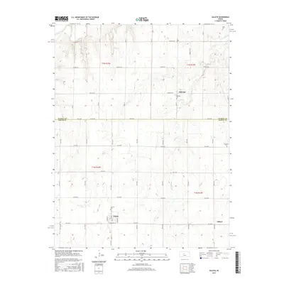
2015 Map of Galatia
USGS Topo · Published 2015About this map
The Smoky Hill River cuts across the northwestern corner of this Kansas landscape, defining a terrain of draws and creek beds that feed into Landon Cr. Centered on the boundary between Russell and Barton counties, the area is anchored by the small settlement of Galatia, where Railroad Ave and Fairview Cem mark the local community's footprint. The map captures a largely agricultural region characterized by a strict grid of section roads, including NW 230 Rd and Stickney Rd. Genealogy researchers will find several localized burial sites scattered throughout the townships, such as Milberger Cem near the community of Milberger and the isolated Trinity Cem in the north. These landmarks, along with the quiet siding of Millard, reflect the persistent but sparse settlement patterns of the central Kansas plains in the early 21st century.
Find a feature on this map
24 named features on this map. Tap any name to fly to it.
Don’t see what you’re looking for? This feature index may not catch every label — zoom into the map to look around manually.
Map Details
Editions of this 2015 Galatia Map
This is the sole edition of this map. No revisions or reprints were ever made.
Other maps of this area

1896 · Russell
USGS Topo · 1:125,000

1896 · Hays
USGS Topo · 1:125,000

1955 · Great Bend
USGS Topo · 1:250,000

1957 · Great Bend
USGS Topo · 1:250,000

1958 · Great Bend
USGS Topo · 1:250,000
1961 · Walker
USGS Topo · 1:24,000

1961 · Russell SW
USGS Topo · 1:24,000

1961 · Homer
USGS Topo · 1:24,000
1965 · Otis
USGS Topo · 1:24,000
1969 · Olmitz
USGS Topo · 1:24,000