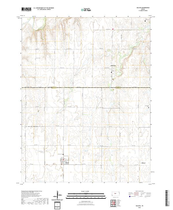
2022 Map of Galatia
USGS Topo · Published 2022About this map
Galatia and the surrounding rural townships of Barton and Russell Counties are defined by a grid of agricultural section lines and quiet prairie drainage. In the southern portion of the map, the settlement of Galatia is anchored by Railroad Ave, though the landscape is primarily dominated by farmstead access roads like NW 190 Rd. Moving north across the county line into Russell County, the community of Milberger and its namesake Milberger Cem sit near the winding course of Landon Cr. Genealogy researchers will find several local burial grounds, including the Trinity Lutheran Cem in the northeast and Schoenfeld Cem to the east. The terrain is marked by the headwaters and tributaries of the Smoky Hill River, which cuts through the northwestern corner near Stickney Rd.
Find a feature on this map
25 named features on this map. Tap any name to fly to it.
Don’t see what you’re looking for? This feature index may not catch every label — zoom into the map to look around manually.
Map Details
Editions of this 2022 Galatia Map
This is the sole edition of this map. No revisions or reprints were ever made.
Other maps of this area

1896 · Russell
USGS Topo · 1:125,000

1896 · Hays
USGS Topo · 1:125,000

1955 · Great Bend
USGS Topo · 1:250,000

1957 · Great Bend
USGS Topo · 1:250,000

1958 · Great Bend
USGS Topo · 1:250,000
1961 · Walker
USGS Topo · 1:24,000

1961 · Russell SW
USGS Topo · 1:24,000

1961 · Homer
USGS Topo · 1:24,000
1965 · Otis
USGS Topo · 1:24,000
1969 · Olmitz
USGS Topo · 1:24,000