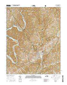
2016 Map of Galax
USGS Topo · Published 2016About this map
The New River carves a winding path through the Blue Ridge foothills, defining the western reach of this survey where the community of Fries and the J R Carico Memorial Bridge are situated. The landscape transitions into the concentrated settlement of Galax, which straddles the Grayson and Carroll county line. The map is exceptionally dense with family-named burial grounds and small communities, including Oldtown, Reavistown, and Woodlawn, reflecting a deep history of rural settlement and local industry at sites like Cox Mill.
Find a feature on this map
63 named features on this map. Tap any name to fly to it.
Don’t see what you’re looking for? This feature index may not catch every label — zoom into the map to look around manually.
Map Details
Editions of this 2016 Galax Map
This is the sole edition of this map. No revisions or reprints were ever made.
Other maps of this area

1889 · Hillsville
USGS Topo · 1:125,000

1889 · Wytheville
USGS Topo · 1:125,000

1892 · Hillsville
USGS Topo · 1:125,000

1892 · Wytheville
USGS Topo · 1:125,000

1896 · Hillsville
USGS Topo · 1:125,000

1930 · Speedwell
USGS Topo · 1:62,500

1930 · Independence
USGS Topo · 1:48,000

1930 · Max Meadows
USGS Topo · 1:62,500

1931 · Galax
USGS Topo · 1:48,000

1933 · Independence
USGS Topo · 1:62,500