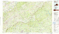
1986 Map of Galax
USGS Topo · Published 1991About this map
Galax and the surrounding Blue Ridge highlands dominate this 1980s survey, showing a landscape defined by the winding Blue Ridge Parkway and the industrial corridors of the Norfolk and Western railroad. The map traces the rugged geography of the Blue Ridge and Macks Mountain, where small communities like Hillsville, Fries, and Stuart are connected by a network of mountain roads and watercourses including the New River and Dan River.
Find a feature on this map
187 named features on this map. Tap any name to fly to it.
Don’t see what you’re looking for? This feature index may not catch every label — zoom into the map to look around manually.
Map Details
Editions of this 1986 Galax Map
2 editions found
Other maps of this area

1887 · Pocahontas
USGS Topo · 1:125,000

1889 · Hillsville
USGS Topo · 1:125,000

1889 · Wytheville
USGS Topo · 1:125,000

1889 · Wilkesboro
USGS Topo · 1:125,000

1890 · Roanoke
USGS Topo · 1:125,000

1890 · Dublin
USGS Topo · 1:125,000

1890 · Christiansburg
USGS Topo · 1:125,000

1891 · Roanoke
USGS Topo · 1:125,000

1891 · Pocahontas
USGS Topo · 1:125,000

1891 · Dublin
USGS Topo · 1:125,000