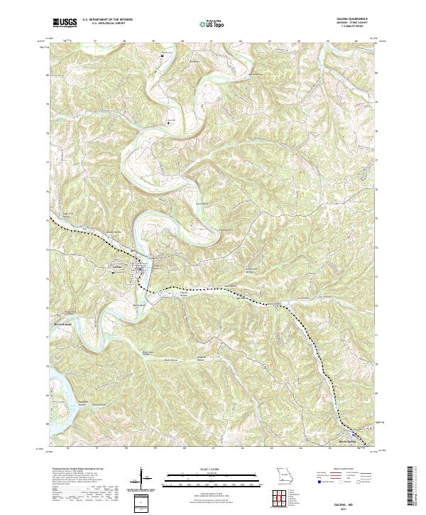
2021 Map of Galena
USGS Topo · Published 2021About this map
The Stone County Courthouse stands as a central landmark in Galena, Missouri, where the James River carves a deep loop around McCord Bend. This modern topographic survey highlights a landscape defined by sharp elevation changes, from the prominent Butler Bluffs to the numerous deeply recessed hollows such as Coon Hollow, Pratt Hollow, and Brushy Hollow. The geography of the region is shaped by the confluence of major waterways, including Crane Creek and Wilson Run, which eventually feed into the northern reaches of Table Rock Lake. For genealogists, the map identifies several local burial grounds including Parsons Cem, Bass Cem, and Galena Cem. To the southeast, the terrain transitions toward Reeds Spring, illustrating the winding road networks and residential developments like Rivermeade Loop and Regal Heights Ln that follow the natural contours of the Ozark plateau.
Find a feature on this map
97 named features on this map. Tap any name to fly to it.
Don’t see what you’re looking for? This feature index may not catch every label — zoom into the map to look around manually.
Map Details
Editions of this 2021 Galena Map
This is the sole edition of this map. No revisions or reprints were ever made.
Other maps of this area

1907 · Forsyth
USGS Topo · 1:125,000

1927 · Shell Knob
USGS Topo · 1:62,500

1942 · Aurora
USGS Topo · 1:62,500

1945 · Harrison
USGS Topo · 1:250,000

1945 · Aurora
USGS Topo · 1:62,500

1949 · Harrison
USGS Topo · 1:250,000

1950 · Shell Knob
USGS Topo · 1:62,500

1950 · Garber
USGS Topo · 1:24,000

1954 · Harrison
USGS Topo · 1:250,000
1955 · Hurley
USGS Topo · 1:24,000