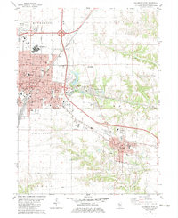
1982 Map of Galesburg East
USGS Topo · Published 1983About this map
Galesburg and Knoxville anchor this detailed study of Knox County, capturing the region's transition from urban density to rural farmland in the early 1980s. The map illustrates a robust institutional landscape, featuring the Galesburg State Mental Health Center, St Marys Hospital, and the campus of Knox College. These centers of healthcare and education are set against a transportation network dominated by the Burlington Northern and Atchison Topeka And Sante Fe railroads, alongside the corridor of Interstate 74.
Find a feature on this map
48 named features on this map. Tap any name to fly to it.
Don’t see what you’re looking for? This feature index may not catch every label — zoom into the map to look around manually.
Map Details
Editions of this 1982 Galesburg East Map
This is the sole edition of this map. No revisions or reprints were ever made.
Other maps of this area

1925 · Galesburg
USGS Topo · 1:62,500

1927 · Galesburg
USGS Topo · 1:62,500

1931 · Galva
USGS Topo · 1:48,000

1940 · Galva
USGS Topo · 1:62,500

1941 · Maquon
USGS Topo · 1:62,500

1943 · Maquon
USGS Topo · 1:62,500

1944 · Galva
USGS Topo · 1:62,500

1947 · Woodhull
USGS Topo · 1:62,500

1958 · Burlington
USGS Topo · 1:250,000

1958 · Davenport
USGS Topo · 1:250,000