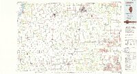
1985 Map of Galesburg
USGS Topo · Published 1986About this map
The Mississippi River forms the western boundary of this 1985 survey, where the river's shoreline is protected by the Big River State Forest and Delabar State Park. This mid-1980s landscape is defined by the intersection of major transportation corridors, with the Burlington Northern and Atchison Topeka and Santa Fe railroads connecting regional hubs like Galesburg and Monmouth. In the eastern portion of the map, the terrain shifts toward heavy industry, noted by the extensive Strip Mine operations surrounding Canton. Cultural and educational centers are well-established, featuring Carl Sandburg College and Monmouth College. Smaller agricultural settlements such as Stronghurst, Roseville, and Abingdon are linked by a grid of state highways and country roads, while several private airfields, including the Wolford Landing Strip and Davies Landing Strip, dot the prairie landscape between the Spoon River and Cedar Creek.
Find a feature on this map
148 named features on this map. Tap any name to fly to it.
Don’t see what you’re looking for? This feature index may not catch every label — zoom into the map to look around manually.
Map Details
Editions of this 1985 Galesburg Map
2 editions found
Other maps of this area

1912 · Canton
USGS Topo · 1:62,500

1912 · Macomb
USGS Topo · 1:62,500

1913 · Colchester
USGS Topo · 1:62,500

1914 · Macomb
USGS Topo · 1:62,500

1915 · Avon
USGS Topo · 1:62,500

1916 · Good Hope
USGS Topo · 1:62,500

1918 · Vermont
USGS Topo · 1:62,500

1918 · La Harpe
USGS Topo · 1:62,500

1918 · Good Hope
USGS Topo · 1:62,500

1921 · Vermont
USGS Topo · 1:62,500