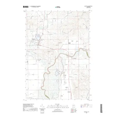
2018 Map of Galesville
USGS Topo · Published 2018About this map
Galesville and Holmen anchor the Trempealeau and La Crosse County border, where the land falls away from high bluffs into the wide, marshy bottomlands of the Black River. The topography is defined by significant rises such as Decorah Peak and Queen Bluff, which overlook a network of waterways including Silver Creek, Beaver Creek, and the expansive wetlands surrounding Van Loon Lake.
Find a feature on this map
101 named features on this map. Tap any name to fly to it.
Don’t see what you’re looking for? This feature index may not catch every label — zoom into the map to look around manually.
Map Details
Editions of this 2018 Galesville Map
This is the sole edition of this map. No revisions or reprints were ever made.
Other maps of this area

1926 · North Bend
USGS Topo · 1:62,500

1927 · La Crosse
USGS Topo · 1:62,500

1929 · Galesville
USGS Topo · 1:62,500

1929 · North Bend
USGS Topo · 1:62,500

1930 · La Crescent
USGS Topo · 1:62,500

1930 · La Crosse
USGS Topo · 1:62,500

1953 · Eau Claire
USGS Topo · 1:250,000

1956 · La Crescent
USGS Topo · 1:62,500

1958 · Eau Claire
USGS Topo · 1:250,000

1958 · La Crosse
USGS Topo · 1:250,000