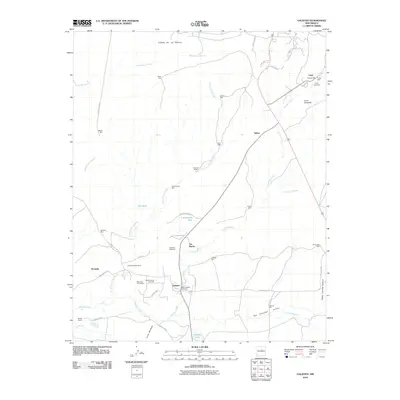
2010 Map of Galisteo
USGS Topo · Published 2010About this map
The high desert basin of Galisteo is defined by a network of seasonal watercourses and scattered ranching outposts south of the Santa Fe area. The landscape is marked by the central Galisteo Creek, which is fed by numerous drainages including the Arroyo de los Angeles and San Cristobal Arroyo. Evidence of earlier indigenous occupation is preserved at the Pueblo of She and Pueblo Largo, located near the northern settlement of Lamy. Transport patterns here are defined by a mix of modern county roads and remnants of the past, most notably the Old Railroad Bed running north to south. Small family and community nodes like Ranchitos De Galisteo and Los Marias are supported by vital water infrastructure, including the School House Windmill and Red Tank, illustrating the reliance on groundwater in this arid terrain.
Find a feature on this map
54 named features on this map. Tap any name to fly to it.
Don’t see what you’re looking for? This feature index may not catch every label — zoom into the map to look around manually.
Map Details
Editions of this 2010 Galisteo Map
This is the sole edition of this map. No revisions or reprints were ever made.
Other maps of this area

1889 · Santa Fe
USGS Topo · 1:125,000

1892 · San Pedro
USGS Topo · 1:125,000

1892 · Santa Clara
USGS Topo · 1:125,000

1894 · Santa Fe
USGS Topo · 1:125,000

1894 · Lamy
USGS Topo · 1:125,000

1951 · Turquoise Hill
USGS Topo · 1:24,000

1952 · Turquoise Hill
USGS Topo · 1:24,000

1952 · Seton Village
USGS Topo · 1:24,000

1953 · Glorieta
USGS Topo · 1:24,000

1953 · Agua Fria
USGS Topo · 1:62,500