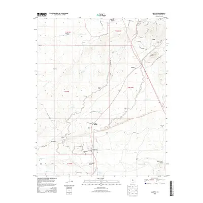
2013 Map of Galisteo
USGS Topo · Published 2013About this map
Galisteo Creek and its various tributaries, including San Cristobal Arroyo and Arroyo Colorado, shape this high-desert corridor in Santa Fe County. The landscape is defined by the historic importance of its water sources, evidenced by numerous named wells and tanks such as Galisteo Well, Red Tank, and the Los Angeles Tank. The village of Galisteo serves as a focal point, anchored by the Galisteo Historic District and the neighboring Old Galisteo Cem and New Galisteo Cem.
Find a feature on this map
75 named features on this map. Tap any name to fly to it.
Don’t see what you’re looking for? This feature index may not catch every label — zoom into the map to look around manually.
Map Details
Editions of this 2013 Galisteo Map
This is the sole edition of this map. No revisions or reprints were ever made.
Other maps of this area

1889 · Santa Fe
USGS Topo · 1:125,000

1892 · San Pedro
USGS Topo · 1:125,000

1892 · Santa Clara
USGS Topo · 1:125,000

1894 · Santa Fe
USGS Topo · 1:125,000

1894 · Lamy
USGS Topo · 1:125,000

1951 · Turquoise Hill
USGS Topo · 1:24,000

1952 · Turquoise Hill
USGS Topo · 1:24,000

1952 · Seton Village
USGS Topo · 1:24,000

1953 · Glorieta
USGS Topo · 1:24,000

1953 · Agua Fria
USGS Topo · 1:62,500