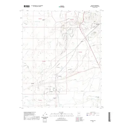
2020 Map of Galisteo
USGS Topo · Published 2020About this map
Galisteo sits as a historic anchor in this Santa Fe County landscape, where the traditional village layout is preserved alongside the Old Galisteo Cem and New Galisteo Cem. The terrain is defined by a network of drainage systems like Galisteo Creek, San Marcos Arroyo, and San Cristobal Arroyo, which historically dictated settlement patterns and travel routes through the high desert. To the north, Lamy marks a significant rail-oriented locale, noted by the Apache Canyon Railroad Bridge Historic Site and the Lamy Cem. The map reveals a complex web of named trails and ranch roads, such as Eliza's Ridge Trail and Saddleback Ranch RD, reflecting a modern layer of land use atop traditional ranching territory. Landmarks like Cerro Colorado and Loma Montosa provide topographic context for the smaller clusters of Spiess and Kennedy.
Find a feature on this map
60 named features on this map. Tap any name to fly to it.
Don’t see what you’re looking for? This feature index may not catch every label — zoom into the map to look around manually.
Map Details
Editions of this 2020 Galisteo Map
This is the sole edition of this map. No revisions or reprints were ever made.
Other maps of this area

1889 · Santa Fe
USGS Topo · 1:125,000

1892 · San Pedro
USGS Topo · 1:125,000

1892 · Santa Clara
USGS Topo · 1:125,000

1894 · Santa Fe
USGS Topo · 1:125,000

1894 · Lamy
USGS Topo · 1:125,000

1951 · Turquoise Hill
USGS Topo · 1:24,000

1952 · Turquoise Hill
USGS Topo · 1:24,000

1952 · Seton Village
USGS Topo · 1:24,000

1953 · Glorieta
USGS Topo · 1:24,000

1953 · Agua Fria
USGS Topo · 1:62,500