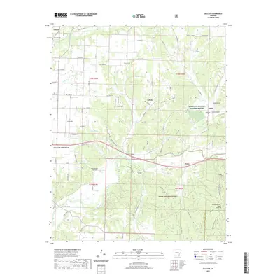
2020 Map of Gallatin
USGS Topo · Published 2020About this map
Lindsley Prairie anchors the northern reaches of this landscape, where the agricultural plains of western Benton County meet the rising timber of the Boston Mountains. The Illinois River winds through the southern half of the quadrangle, joined by tributaries like Osage Creek and Chambers Spring Branch. This modern survey illustrates the conservation footprint of the region, specifically the Logan Cave National Wildlife Refuge and a section of the Ozark National Forest near Pedro. Genealogists will find a high density of rural burial grounds, including Lone Elm Cem, Fairmount Cem, and Martin Cem. The transition from the developed outskirts of Siloam Springs and Gentry to the prominent heights of the Twin Mountains, featuring Upper Round Top and Lower Round Top, defines the local topography.
Find a feature on this map
99 named features on this map. Tap any name to fly to it.
Don’t see what you’re looking for? This feature index may not catch every label — zoom into the map to look around manually.
Map Details
Editions of this 2020 Gallatin Map
This is the sole edition of this map. No revisions or reprints were ever made.
Other maps of this area

1899 · Fayetteville
USGS Topo · 1:125,000

1899 · Siloam Springs
USGS Topo · 1:125,000

1901 · Fayetteville
USGS Topo · 1:125,000

1903 · Siloam Springs
USGS Topo · 1:125,000

1904 · Siloam Springs
USGS Topo · 1:125,000

1904 · Fayetteville
USGS Topo · 1:125,000

1954 · Tulsa
USGS Topo · 1:250,000

1958 · Tulsa
USGS Topo · 1:250,000

1963 · Tulsa
USGS Topo · 1:250,000

1970 · Gallatin
USGS Topo · 1:24,000