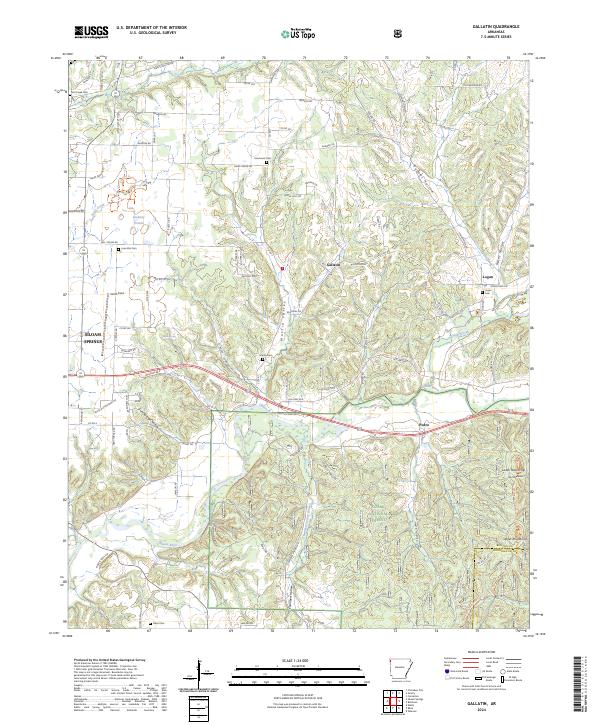
2024 Map of Gallatin
USGS Topo · Published 2024About this map
The Illinois River flows across this corner of the Ozark plateau, cutting through a landscape of hollows and high prairies just east of Siloam Springs. The terrain transitions from the open stretches of Lindsley Prairie to the intricate drainages of Martin Valley and Gum Springs Hollow. This 2024 survey captures a rural network of family and community landmarks, including numerous burial grounds like Lone Elm Cem, Fairmount Cem, and Shady Grove Cem.
Find a feature on this map
91 named features on this map. Tap any name to fly to it.
Don’t see what you’re looking for? This feature index may not catch every label — zoom into the map to look around manually.
Map Details
Editions of this 2024 Gallatin Map
This is the sole edition of this map. No revisions or reprints were ever made.
Other maps of this area

1899 · Fayetteville
USGS Topo · 1:125,000

1899 · Siloam Springs
USGS Topo · 1:125,000

1901 · Fayetteville
USGS Topo · 1:125,000

1903 · Siloam Springs
USGS Topo · 1:125,000

1904 · Siloam Springs
USGS Topo · 1:125,000

1904 · Fayetteville
USGS Topo · 1:125,000

1954 · Tulsa
USGS Topo · 1:250,000

1958 · Tulsa
USGS Topo · 1:250,000

1963 · Tulsa
USGS Topo · 1:250,000

1970 · Gallatin
USGS Topo · 1:24,000