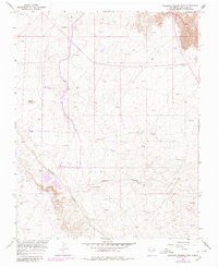
1965 Map of Gallegos Trading Post
USGS Topo · Published 1980About this map
Gallegos Canyon and its many tributaries define this high-desert landscape in San Juan County, where mid-century energy development intersects with traditional Navajo Nation trading history. The sheet is dominated by an extensive network of extractive infrastructure, including numerous Gas Wells and Oil Wells connected by a web of service roads and pipelines. A critical link to the area's cultural history is marked at the Gallegos Trading Post (Site), situated near the canyon floor. Water management in this arid environment is evidenced by the presence of Pete Spring and isolated landmarks like the McKay Windmill and Gallegos Windmill. Later aerial revisions show the growth of regional utilities, including a Pumping Sta and expanded pipeline corridors that cross the rugged drainage of Cedar Canyon.
Find a feature on this map
11 named features on this map. Tap any name to fly to it.
Don’t see what you’re looking for? This feature index may not catch every label — zoom into the map to look around manually.
Map Details
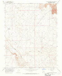
Editions of this 1965 Gallegos Trading Post Map
2 editions found
Other maps of this area

1889 · Largo
USGS Topo · 1:250,000

1889 · Chaco
USGS Topo · 1:250,000

1892 · Chaco
USGS Topo · 1:250,000

1895 · Largo
USGS Topo · 1:250,000

1954 · Shiprock
USGS Topo · 1:250,000

1954 · Aztec
USGS Topo · 1:250,000

1958 · Shiprock
USGS Topo · 1:250,000

1958 · Aztec
USGS Topo · 1:250,000

1959 · Shiprock
USGS Topo · 1:250,000

1960 · Bloomfield
USGS Topo · 1:62,500
Featured Places
- Eastern Navajo Agency, NM
- Huerfano, Eastern Navajo Agency
- Teeł Sikaad, Eastern Navajo Agency
- San Juan County, NM
- United States