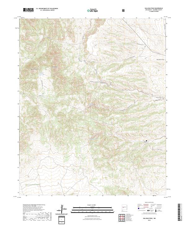
2023 Map of Gallinas Peak
USGS Topo · Published 2023About this map
Gallinas Peak stands as the primary landmark in this high-elevation corner of the Cibola National Forest within Socorro County. The terrain is defined by the sharp rise of the Gallinas Mountains, which are dissected by numerous drainages including McGee Canyon, Deep Well Canyon, and Gallinas Canyon. This landscape reflects a history of water management and land use in a demanding environment, evidenced by named water sources like McGee Spring, Gallinas Spring, and functional infrastructure such as Gallinas Trick Tank and Rock Header Tank. For genealogists and local historians, the inclusion of Medley Cem provides a specific point of interest for tracing family roots in this isolated mountain territory. The network of forest roads, including Forest Rd 469 and Forest Rd 10, indicates the ongoing importance of access for timber and resource management within the national forest system.
Find a feature on this map
20 named features on this map. Tap any name to fly to it.
Don’t see what you’re looking for? This feature index may not catch every label — zoom into the map to look around manually.
Map Details
Editions of this 2023 Gallinas Peak Map
This is the sole edition of this map. No revisions or reprints were ever made.
Other maps of this area

1954 · Socorro
USGS Topo · 1:250,000

1958 · Socorro
USGS Topo · 1:250,000

1962 · Socorro
USGS Topo · 1:250,000

1963 · Arroyo Landavaso
USGS Topo · 1:24,000

1964 · Arrowhead Well
USGS Topo · 1:24,000

1964 · Indian Mesa
USGS Topo · 1:24,000

1964 · Silver Hill
USGS Topo · 1:24,000

1964 · Tres Montosas
USGS Topo · 1:24,000

1964 · Gallinas Peak
USGS Topo · 1:24,000

1964 · Lion Mountain
USGS Topo · 1:24,000