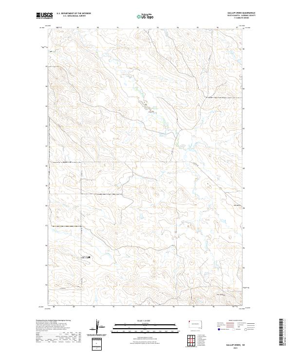
2021 Map of Gallup Creek
USGS Topo · Published 2021About this map
Alma Cem sits in the southwestern reaches of this Harding County landscape, a quiet marker of the homesteading families who once worked these vast Dakota pastures. The terrain is defined by a network of seasonal drainages, including Gallup Cr, Smiley Cr, and Oley Cr, which feed into small impoundments such as Kemp Reservoir and Peterson Reservoir. These water sources were vital for livestock in a region where cattle ranching has long been the primary economic driver. To the southeast, the land breaks away sharply at The Jumpoff, a significant geological escarpment that contrasts with the more gradual slopes of Red Butte. The map details a sparse but essential road network including Bullock Rd and Latham Rd, illustrating the isolation and resilience of life on the Great Plains in the modern era.
Find a feature on this map
21 named features on this map. Tap any name to fly to it.
Don’t see what you’re looking for? This feature index may not catch every label — zoom into the map to look around manually.
Map Details
Editions of this 2021 Gallup Creek Map
This is the sole edition of this map. No revisions or reprints were ever made.
Other maps of this area

1935 · Buffalo
USGS Topo · 1:125,000

1954 · Lemmon
USGS Topo · 1:250,000

1957 · Lemmon
USGS Topo · 1:250,000

1969 · Ladner
USGS Topo · 1:24,000
1971 · Lahti Butte
USGS Topo · 1:24,000

1971 · Saddle Butte
USGS Topo · 1:24,000

1973 · Gallup Creek
USGS Topo · 1:24,000

1974 · Caroline Butte
USGS Topo · 1:24,000

1974 · Pine Spring
USGS Topo · 1:24,000
1977 · Scott Creek
USGS Topo · 1:24,000