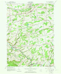
1944 Map of Gallupville
USGS Topo · Published 1973About this map
Gallupville and the winding course of Fox Creek anchor this 1944 survey of the borderlands between Schenectady, Albany, and Schoharie Counties. The landscape is defined by a dense network of district schools and rural crossroads, where the Delaware and Hudson railroad cuts through the northern reach near Delanson and Quaker Street. These rail-connected settlements contrast with the agricultural character of the southern hills, where family-named landmarks like Zimmer Hill and the Zimmer Cem reflect generations of local settlement. Along the valley floor, the villages of West Berne and Berne follow the path of Beaverdam Creek, illustrating a classic mid-century upstate New York pattern of small-scale industry and community life centered on reliable water power and fertile creek bottoms.
Find a feature on this map
33 named features on this map. Tap any name to fly to it.
Don’t see what you’re looking for? This feature index may not catch every label — zoom into the map to look around manually.
Map Details
Editions of this 1944 Gallupville Map
Other maps of this area

1895 · Amsterdam
USGS Topo · 1:62,500

1896 · Fonda
USGS Topo · 1:62,500

1898 · Fonda
USGS Topo · 1:62,500

1898 · Schoharie
USGS Topo · 1:62,500

1900 · Schoharie
USGS Topo · 1:62,500

1900 · Schoharie
USGS Topo · 1:31,680

1900 · Berne
USGS Topo · 1:62,500

1902 · Fonda
USGS Topo · 1:62,500

1903 · Berne
USGS Topo · 1:62,500

1931 · Amsterdam
USGS Topo · 1:62,500