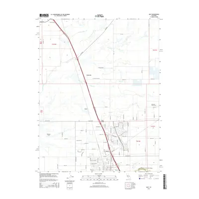
2015 Map of Galt
USGS Topo · Published 2015About this map
Galt sits at the heart of this Sacramento Valley landscape, where the northern boundary of San Joaquin County meets Sacramento County. The map reveals a transition from the structured residential grid of the city to the expansive agricultural lands and riparian corridors of the Cosumnes River and its various overflows. To the north, the small settlement of Hicksville and its nearby Hicksville Cemetery provide historical anchoring points along the Dillard Rd corridor. The geography is defined by a network of waterways including Willow Creek, Skunk Cr, and the appropriately named Deadman Gulch. Small-scale aviation is represented by facilities like Mustang Airport and Bottimore Ranch Airport, illustrating the region's reliance on both land and air for connectivity across the central valley.
Find a feature on this map
101 named features on this map. Tap any name to fly to it.
Don’t see what you’re looking for? This feature index may not catch every label — zoom into the map to look around manually.
Map Details
Editions of this 2015 Galt Map
This is the sole edition of this map. No revisions or reprints were ever made.
Other maps of this area

1894 · Lodi
USGS Topo · 1:125,000

1908 · Lockeford
USGS Topo · 1:31,680

1909 · Elk Grove
USGS Topo · 1:31,680

1909 · Clay
USGS Topo · 1:31,680

1909 · Cosumnes
USGS Topo · 1:31,680

1909 · Florin
USGS Topo · 1:31,680

1910 · New Hope
USGS Topo · 1:31,680

1910 · Woodbridge
USGS Topo · 1:31,680

1910 · Bruceville
USGS Topo · 1:31,680

1910 · Galt
USGS Topo · 1:31,680