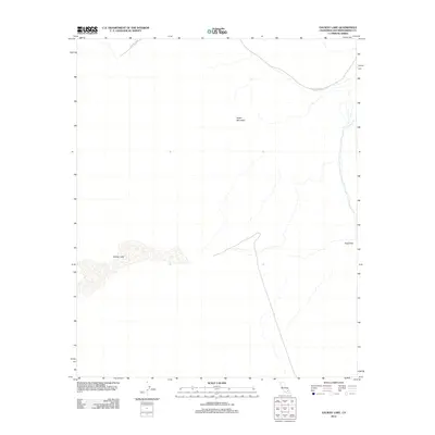
2012 Map of Galway Lake
USGS Topo · Published 2012About this map
Galway Lake sits at the heart of this high desert terrain, depicted here during a 2012 survey of the Southern California landscape. This area is defined by the stark topography of Argos Mountain and the transition through Gays Pass, illustrating the geographic isolation of the San Bernardino County interior. The presence of the 29 Palms MCAG boundary indicates the intersection of military land management and the natural desert environment. The map provides a precise view of the dry lake bed and surrounding contours, essential for understanding the hydrology and land use patterns of this specific Mojave Desert quadrangle during the early 21st century.
Find a feature on this map
4 named features on this map. Tap any name to fly to it.
Don’t see what you’re looking for? This feature index may not catch every label — zoom into the map to look around manually.
Map Details
Editions of this 2012 Galway Lake Map
This is the sole edition of this map. No revisions or reprints were ever made.
Other maps of this area

1901 · Southern California Sheet No. 1
USGS Topo · 1:250,000

1902 · San Gorgonio
USGS Topo · 1:125,000

1904 · Southern California Sheet No. 1
USGS Topo · 1:250,000

1953 · San Bernardino
USGS Topo · 1:250,000

1954 · Galway Lake
USGS Topo · 1:24,000

1954 · Hidalgo Mtn
USGS Topo · 1:24,000

1954 · Emerson Lake
USGS Topo · 1:24,000

1955 · Lavic SE
USGS Topo · 1:24,000

1955 · Silver Bell Mine
USGS Topo · 1:24,000

1955 · Sunshine Peak
USGS Topo · 1:24,000