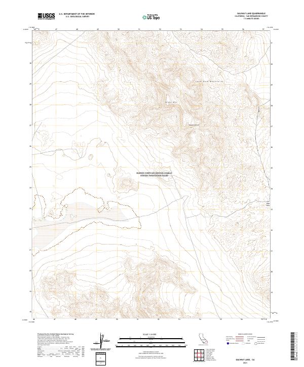
2021 Map of Galway Lake
USGS Topo · Published 2021About this map
The Lava Bed Mountains dominate this section of the Mojave Desert, revealing a landscape defined by volcanic geology and significant relief. At the heart of the range sits Argos Mtn, a prominent summit surrounded by a complex system of ridges and washes. This 2021 survey by the U.S. Geological Survey illustrates the township and range grid (T6N R5E, T6N R6E, T5N R5E, T5N R6E) as it overlays the arid terrain, providing a precise look at the topographical contours of the high desert. In the eastern portion of the sheet, the terrain narrows at Gays Pass, a natural corridor through the mountains. The map captures the isolation of this corner of San Bernardino County, where land management boundaries from the BLM and FWS intersect with the ancient geological formations of the northern desert interior.
Find a feature on this map
8 named features on this map. Tap any name to fly to it.
Don’t see what you’re looking for? This feature index may not catch every label — zoom into the map to look around manually.
Map Details
Editions of this 2021 Galway Lake Map
This is the sole edition of this map. No revisions or reprints were ever made.
Other maps of this area

1901 · Southern California Sheet No. 1
USGS Topo · 1:250,000

1902 · San Gorgonio
USGS Topo · 1:125,000

1904 · Southern California Sheet No. 1
USGS Topo · 1:250,000

1953 · San Bernardino
USGS Topo · 1:250,000

1954 · Galway Lake
USGS Topo · 1:24,000

1954 · Hidalgo Mtn
USGS Topo · 1:24,000

1954 · Emerson Lake
USGS Topo · 1:24,000

1955 · Lavic SE
USGS Topo · 1:24,000

1955 · Silver Bell Mine
USGS Topo · 1:24,000

1955 · Sunshine Peak
USGS Topo · 1:24,000