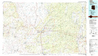
1984 Map of Ganado
USGS Topo · Published 1984About this map
The Hubbell Trading Post National Historic Site anchors this mid-1980s look at the high plateau country within the Navajo Indian Reservation. This map captures a landscape defined by significant cultural and educational institutions, including the Kinlichee Boarding School, Steamboat School, and Greasewood School. The topography is dominated by the broad Defiance Plateau and the sharp rise of the Chuska Mountains along the Arizona-New Mexico border.
Find a feature on this map
41 named features on this map. Tap any name to fly to it.
Don’t see what you’re looking for? This feature index may not catch every label — zoom into the map to look around manually.
Map Details
Editions of this 1984 Ganado Map
2 editions found
Other maps of this area

1883 · Marsh Pass
USGS Topo · 1:250,000

1883 · Tusayan
USGS Topo · 1:250,000

1886 · Wingate
USGS Topo · 1:250,000

1886 · Tusayan
USGS Topo · 1:250,000

1886 · Fort Defiance
USGS Topo · 1:250,000

1889 · Chaco
USGS Topo · 1:250,000

1892 · Fort Defiance
USGS Topo · 1:250,000

1892 · Marsh Pass
USGS Topo · 1:250,000

1892 · Wingate
USGS Topo · 1:250,000

1892 · Chaco
USGS Topo · 1:250,000
Featured Places
- Chinle Agency, AZ
- Fort Defiance Agency
- Fort Defiance, Fort Defiance Agency
- Window Rock, Fort Defiance Agency
- Eastern Navajo Agency, NM