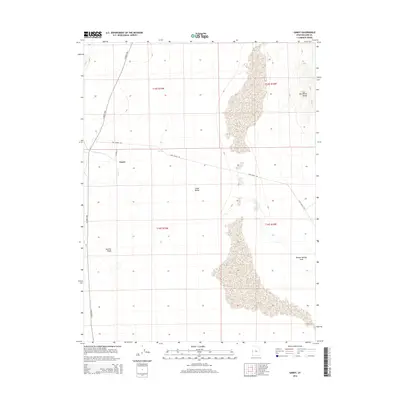
2014 Map of Gandy
USGS Topo · Published 2014About this map
Gandy stands as a primary point of reference in this pocket of the eastern Snake Valley, where the Great Basin landscape meets the rising topography of the Salt Marsh Range. The settlement is closely tied to local water resources, positioned near Swan Cr and the vital Gandy Spring. The map documents a sparse but deliberate network of ranch roads and lanes, including Foot Ranch Rd and N Young Ln, which thread through the desert flats to connect isolated points of interest. To the southeast, the Bishop Springs Area provides a distinct hydrological feature within this arid basin, while the drainage of Marble Wash illustrates the erosional character of the western slopes. This 2014 survey records the modern footprint of land management and rural access in Millard County, preserved through detailed contouring and public land survey system boundaries.
Find a feature on this map
14 named features on this map. Tap any name to fly to it.
Don’t see what you’re looking for? This feature index may not catch every label — zoom into the map to look around manually.
Map Details
Editions of this 2014 Gandy Map
This is the sole edition of this map. No revisions or reprints were ever made.
Other maps of this area

1908 · Fish Springs
USGS Topo · 1:250,000

1910 · Fish Springs
USGS Topo · 1:250,000

1953 · Delta
USGS Topo · 1:250,000

1956 · Ely
USGS Topo · 1:250,000

1958 · Delta
USGS Topo · 1:250,000

1959 · Ely
USGS Topo · 1:250,000

1960 · Gandy
USGS Topo · 1:62,500

1961 · Trout Creek
USGS Topo · 1:62,500

1962 · Delta
USGS Topo · 1:250,000

1963 · Ely
USGS Topo · 1:250,000