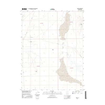
2017 Map of Gandy
USGS Topo · Published 2017About this map
Gandy stands as a small, isolated outpost in the expansive basin of western Utah, positioned along the edge of the Snake Valley. This region is defined by its arid landscape and internal drainage patterns, where water from Swan Cr and Cold Spring emerges only to be absorbed by the surrounding desert floor. To the east, the rising slopes of the Salt Marsh Range frame the valley, highlighting the dramatic elevation shifts between the basin floor and the surrounding highlands. The local transportation network is minimal, relying on routes like Gandy Rd and Foot Ranch Rd to connect the sparse homesteads. Natural drainage features such as Marble Wash cut through the terrain, illustrating the occasional but powerful impact of water in this high-desert environment during the early 21st century.
Find a feature on this map
12 named features on this map. Tap any name to fly to it.
Don’t see what you’re looking for? This feature index may not catch every label — zoom into the map to look around manually.
Map Details
Editions of this 2017 Gandy Map
This is the sole edition of this map. No revisions or reprints were ever made.
Other maps of this area

1908 · Fish Springs
USGS Topo · 1:250,000

1910 · Fish Springs
USGS Topo · 1:250,000

1953 · Delta
USGS Topo · 1:250,000

1956 · Ely
USGS Topo · 1:250,000

1958 · Delta
USGS Topo · 1:250,000

1959 · Ely
USGS Topo · 1:250,000

1960 · Gandy
USGS Topo · 1:62,500

1961 · Trout Creek
USGS Topo · 1:62,500

1962 · Delta
USGS Topo · 1:250,000

1963 · Ely
USGS Topo · 1:250,000