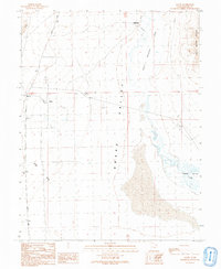
1991 Map of Gandy
USGS Topo · Published 1991About this map
Snake Valley serves as the focal point for this Great Basin landscape, where water dictates the location of human activity and survival. The small settlement of Gandy and the nearby Smithville sit on the edge of a high-desert environment dominated by the Salt Marsh Lake to the east and the Salt Marsh Range rising beyond. The importance of perennial water is evident in features like Warm Creek, Cold Spring, and the expansive Bishop Springs Area, which contrast with the ephemeral drainage of Marble Wash. Genealogists and local historians may find interest in the isolated Grave located north of Gandy Road, a solitary marker of the area's pioneer history. The presence of multiple Gravel Pits and various wells indicates the ongoing efforts to maintain infrastructure and water access in this arid pocket of Millard County near the Nevada border.
Find a feature on this map
17 named features on this map. Tap any name to fly to it.
Don’t see what you’re looking for? This feature index may not catch every label — zoom into the map to look around manually.
Map Details
Editions of this 1991 Gandy Map
This is the sole edition of this map. No revisions or reprints were ever made.
Other maps of this area

1908 · Fish Springs
USGS Topo · 1:250,000

1910 · Fish Springs
USGS Topo · 1:250,000

1953 · Delta
USGS Topo · 1:250,000

1956 · Ely
USGS Topo · 1:250,000

1958 · Delta
USGS Topo · 1:250,000

1959 · Ely
USGS Topo · 1:250,000

1960 · Gandy
USGS Topo · 1:62,500

1961 · Trout Creek
USGS Topo · 1:62,500

1962 · Delta
USGS Topo · 1:250,000

1963 · Ely
USGS Topo · 1:250,000