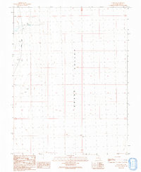
1991 Map of Gandy SW
USGS Topo · Published 1991About this map
Snake Valley defines this arid landscape in western Millard County, where human presence is marked primarily by infrastructure for water and resource extraction. The 1991 provisional survey reveals a remote area along the Gandy Road, where the reliance on scarce water is evidenced by labels for an Aqueduct and a Well. Local history is captured in small but significant markers like the Graves located in the northwest corner, a rare genealogical touchpoint in a sparsely populated region. Evidence of industrial activity appears in the form of a Gravel Pit and a Drill Hole, reflecting the ongoing utilitarian use of the desert floor during the late twentieth century. This map serves as a clear record of the high-desert terrain, noting survey benchmarks such as BM 4935 and Section lines that delineate the open expanse of the Great Basin.
Find a feature on this map
13 named features on this map. Tap any name to fly to it.
Don’t see what you’re looking for? This feature index may not catch every label — zoom into the map to look around manually.
Map Details
Editions of this 1991 Gandy SW Map
This is the sole edition of this map. No revisions or reprints were ever made.
Other maps of this area

1908 · Fish Springs
USGS Topo · 1:250,000

1910 · Fish Springs
USGS Topo · 1:250,000

1953 · Delta
USGS Topo · 1:250,000

1956 · Ely
USGS Topo · 1:250,000

1958 · Delta
USGS Topo · 1:250,000

1959 · Ely
USGS Topo · 1:250,000

1960 · Conger Range
USGS Topo · 1:62,500

1960 · Gandy
USGS Topo · 1:62,500

1962 · Delta
USGS Topo · 1:250,000

1963 · Ely
USGS Topo · 1:250,000