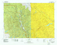
1978 Map of Gannett Peak
USGS Topo · Published 1987About this map
Gannett Peak stands as the highest point on the Continental Divide within this topographic survey, marking the jagged spine of the Wind River Range. The landscape is defined by the contrast between the alpine heights of the Bridger Wilderness and the broad valley floor of the Wind River Indian Reservation. High-altitude water sources like Fremont Lake and New Fork Lakes feed the western slopes, while the eastern drainage is dominated by the course of the Wind River. Small communities and outposts such as Burris, Crowheart, and Lenore are situated along the lower elevations, primarily following the path of the river and highway. The mapping reveals a complex glacial geography where high plateaus like Goat Flat and prominent ridges such as Piñon Ridge separate vast drainage basins across the Fremont and Sublette county lines.
Find a feature on this map
38 named features on this map. Tap any name to fly to it.
Don’t see what you’re looking for? This feature index may not catch every label — zoom into the map to look around manually.
Map Details
Editions of this 1978 Gannett Peak Map
2 editions found
Other maps of this area

1902 · Mt Leidy
USGS Topo · 1:125,000

1904 · Kirwin
USGS Topo · 1:125,000

1905 · Younts Peak
USGS Topo · 1:125,000

1906 · Kirwin
USGS Topo · 1:125,000

1907 · Younts Peak
USGS Topo · 1:125,000

1907 · Gros Ventre
USGS Topo · 1:125,000

1909 · Fremont Peak
USGS Topo · 1:125,000

1910 · Gros Ventre
USGS Topo · 1:125,000

1937 · Moccasin Lake
USGS Topo · 1:48,000

1938 · Mt Bonneville
USGS Topo · 1:62,500