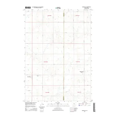
2015 Map of Gannvalley
USGS Topo · Published 2015About this map
Gannvalley sits as a primary settlement in this portion of South Dakota, serving as a hub for the surrounding agricultural plains. The landscape is defined by the winding path of Crow Cr, which cuts through the prairie toward the southeast. To the east, the Spring Valley Colony represents a distinct communal settlement pattern, reflecting the localized social and land-use traditions of the region. Local history is anchored at the Spring Hill Cem, located just outside the main town site. The terrain is largely defined by a regular grid of section roads, including 231st St and 361st Ave, which frame the upland areas and depressions like Coyote Holw. This 2015 survey illustrates how traditional rural townships and newer agricultural colonies coexist within the modern Buffalo County and Jerauld County borders.
Find a feature on this map
25 named features on this map. Tap any name to fly to it.
Don’t see what you’re looking for? This feature index may not catch every label — zoom into the map to look around manually.
Map Details
Editions of this 2015 Gannvalley Map
This is the sole edition of this map. No revisions or reprints were ever made.
Other maps of this area

1941 · Pukwana
USGS Topo · 1:62,500

1941 · Kimball North
USGS Topo · 1:62,500

1951 · Pukwana
USGS Topo · 1:62,500

1951 · Kimball North
USGS Topo · 1:62,500

1953 · Huron
USGS Topo · 1:250,000

1954 · Huron
USGS Topo · 1:250,000

1955 · Mitchell
USGS Topo · 1:250,000

1959 · Mitchell
USGS Topo · 1:250,000

1973 · Big Bend Dam 4 SE
USGS Topo · 1:24,000

1973 · Gannvalley
USGS Topo · 1:24,000