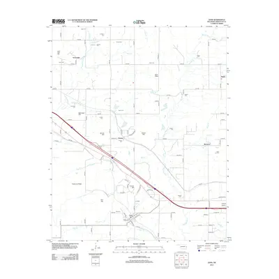
2012 Map of Gans
USGS Topo · Published 2012About this map
Gans serves as a focal point in this portion of Sequoyah County, where the landscape transitions from the residential streets of Jackson Ave and Cherokee St into a rugged series of ridges and creek bottoms. The topography is defined by prominent elevations such as Krumpe Mtn, Baldridge Mtn, and Hickorynut Ridge, which frame the drainages of Big Skin Bayou and Little Sallisaw Cr.
Find a feature on this map
69 named features on this map. Tap any name to fly to it.
Don’t see what you’re looking for? This feature index may not catch every label — zoom into the map to look around manually.
Map Details
Editions of this 2012 Gans Map
This is the sole edition of this map. No revisions or reprints were ever made.
Other maps of this area

1898 · Tahlequah
USGS Topo · 1:125,000

1900 · Sallisaw
USGS Topo · 1:125,000

1901 · Tahlequah
USGS Topo · 1:125,000

1905 · Tahlequah
USGS Topo · 1:125,000

1911 · Sallisaw
USGS Topo · 1:125,000

1946 · Fort Smith
USGS Topo · 1:250,000

1965 · Fort Smith
USGS Topo · 1:250,000
1966 · Muldrow
USGS Topo · 1:24,000

1966 · Gans
USGS Topo · 1:24,000

1966 · Muldrow SW
USGS Topo · 1:24,000