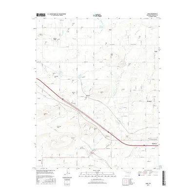
2016 Map of Gans
USGS Topo · Published 2016About this map
Big Skin Bayou and its many tributaries, including Wilson Br and Onion Cr, carve a complex drainage pattern through this section of Sequoyah County. The landscape is defined by a series of prominent elevations such as Wildhorse Mtn, Burrow Mtn, and Krumpe Mtn, which rise sharply above the surrounding valley floors. The settlement pattern is largely rural, centered on the incorporated town of Gans and the community of Muldrow, with smaller hamlets like Blackjack and Akins scattered along the local road network.
Find a feature on this map
112 named features on this map. Tap any name to fly to it.
Don’t see what you’re looking for? This feature index may not catch every label — zoom into the map to look around manually.
Map Details
Editions of this 2016 Gans Map
This is the sole edition of this map. No revisions or reprints were ever made.
Other maps of this area

1898 · Tahlequah
USGS Topo · 1:125,000

1900 · Sallisaw
USGS Topo · 1:125,000

1901 · Tahlequah
USGS Topo · 1:125,000

1905 · Tahlequah
USGS Topo · 1:125,000

1911 · Sallisaw
USGS Topo · 1:125,000

1946 · Fort Smith
USGS Topo · 1:250,000

1965 · Fort Smith
USGS Topo · 1:250,000
1966 · Muldrow
USGS Topo · 1:24,000

1966 · Gans
USGS Topo · 1:24,000

1966 · Muldrow SW
USGS Topo · 1:24,000