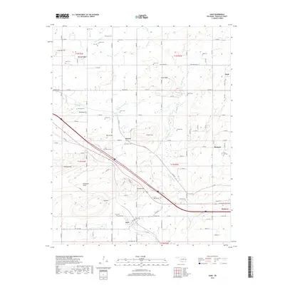
2018 Map of Gans
USGS Topo · Published 2018About this map
Gans and the western edge of Muldrow anchor the southern portion of this Sequoyah County landscape, where the terrain transitions from the lowlands of Big Skin Bayou into a series of prominent elevations. The topographic relief is defined by numerous named peaks and ridges, including Wildhorse Mtn, Hanson Mtn, and Krumpe Mtn, which overlook a network of small family-named settlements and rural intersections. This 2018 survey reveals a high density of historical burial sites, such as Faulkner Cem, Lessley Cem, and Seabolt Cem, which are often located near the base of these ridges.
Find a feature on this map
112 named features on this map. Tap any name to fly to it.
Don’t see what you’re looking for? This feature index may not catch every label — zoom into the map to look around manually.
Map Details
Editions of this 2018 Gans Map
This is the sole edition of this map. No revisions or reprints were ever made.
Other maps of this area

1898 · Tahlequah
USGS Topo · 1:125,000

1900 · Sallisaw
USGS Topo · 1:125,000

1901 · Tahlequah
USGS Topo · 1:125,000

1905 · Tahlequah
USGS Topo · 1:125,000

1911 · Sallisaw
USGS Topo · 1:125,000

1946 · Fort Smith
USGS Topo · 1:250,000

1965 · Fort Smith
USGS Topo · 1:250,000
1966 · Muldrow
USGS Topo · 1:24,000

1966 · Gans
USGS Topo · 1:24,000

1966 · Muldrow SW
USGS Topo · 1:24,000