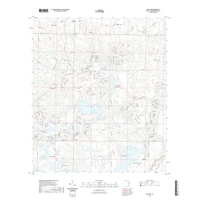
2021 Map of Gap Lake
USGS Topo · Published 2021About this map
Wausau serves as a central hub in this section of Washington County, where the landscape is defined by an intricate network of wetlands, ponds, and small creeks. The terrain transitions from higher ground at Mud Hill and Sexton Hill toward a low-lying southern basin dominated by Gap Lake and Gin Lake. This survey illustrates a complex water system, ranging from the Sodom Swamp in the northwest to the larger Mobile Swamp and Gap Lake Swamp.
Find a feature on this map
252 named features on this map. Tap any name to fly to it.
Don’t see what you’re looking for? This feature index may not catch every label — zoom into the map to look around manually.
Map Details
Editions of this 2021 Gap Lake Map
This is the sole edition of this map. No revisions or reprints were ever made.
Other maps of this area

1944 · Crystal Lake
USGS Topo · 1:24,000

1944 · Bennett
USGS Topo · 1:24,000

1945 · Bennett
USGS Topo · 1:31,680

1945 · Crystal Lake
USGS Topo · 1:31,680

1945 · Fountain
USGS Topo · 1:31,680

1950 · Vernon
USGS Topo · 1:24,000

1950 · Wausau
USGS Topo · 1:24,000

1950 · Gap Lake
USGS Topo · 1:24,000

1950 · Poplar Head
USGS Topo · 1:24,000

1951 · Wausau
USGS Topo · 1:24,000