
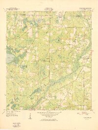
1950 Map of Gap Lake
USGS Topo · Published 1971About this map
Mobile Swamp and a dense network of freshwater basins dominate this 1950 topography of the Florida Panhandle. The landscape is defined by its diverse wetlands, from the expansive Gap Lake and its associated Gap Lake Swamp to smaller, curiously named features like Lighter Log Pond, Smooth Iron Pond, and Dog Hole. Small rural centers such as Daniels and Daddy Hole appear alongside scattered family burial grounds, including Deadening Cem, White Oak Cem, and Barfield Cem. Community life is anchored by several local congregations, notably Gap Pond Ch and White Oak Ch. Significant topographical markers like Chalk Hill and Hicks Head rise above the surrounding swampy terrain, while the Lookout Tower near the center of the sheet highlights the region's managed timberland history.
Find a feature on this map
77 named features on this map. Tap any name to fly to it.
Don’t see what you’re looking for? This feature index may not catch every label — zoom into the map to look around manually.
Map Details
Editions of this 1950 Gap Lake Map
This is the sole edition of this map. No revisions or reprints were ever made.
Other maps of this area

1944 · Crystal Lake
USGS Topo · 1:24,000

1944 · Bennett
USGS Topo · 1:24,000

1945 · Bennett
USGS Topo · 1:31,680

1945 · Crystal Lake
USGS Topo · 1:31,680

1945 · Fountain
USGS Topo · 1:31,680

1950 · Vernon
USGS Topo · 1:24,000

1950 · Wausau
USGS Topo · 1:24,000

1950 · Poplar Head
USGS Topo · 1:24,000

1951 · Wausau
USGS Topo · 1:24,000
1951 · Poplar Head
USGS Topo · 1:24,000