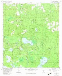
1982 Map of Gap Lake
USGS Topo · Published 1983About this map
The settlement of Wausau and the burgeoning residential layout of Sunny Hills anchor this 1982 survey of Washington County. This landscape is defined by its complex hydrology, where the large expanse of Gap Lake sits at the center of a network of swamps and ponds, including the Mobile Swamp and the distinctive Double Pond. The map captures a moment of transition as the rural character of the area, represented by family-named landmarks like Lay Cem and Bartlett Cem, meets the planned development of the south, marked by the extensive street grid of Sunny Hills Blvd and Deltona Blvd.
Find a feature on this map
93 named features on this map. Tap any name to fly to it.
Don’t see what you’re looking for? This feature index may not catch every label — zoom into the map to look around manually.
Map Details
Editions of this 1982 Gap Lake Map
This is the sole edition of this map. No revisions or reprints were ever made.
Other maps of this area

1944 · Crystal Lake
USGS Topo · 1:24,000

1944 · Bennett
USGS Topo · 1:24,000

1945 · Bennett
USGS Topo · 1:31,680

1945 · Crystal Lake
USGS Topo · 1:31,680

1945 · Fountain
USGS Topo · 1:31,680

1950 · Vernon
USGS Topo · 1:24,000

1950 · Wausau
USGS Topo · 1:24,000

1950 · Gap Lake
USGS Topo · 1:24,000

1950 · Poplar Head
USGS Topo · 1:24,000

1951 · Wausau
USGS Topo · 1:24,000