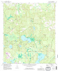
1994 Map of Gap Lake
USGS Topo · Published 1995About this map
Gap Lake sits at the center of this landscape in Washington County, surrounded by a complex network of wetlands including Sodom Swamp and Gap Lake Swamp. The area around Wausau and the burgeoning community of Sunny Hills is marked by numerous family-named landmarks and cemeteries, such as Lay Cem and Bartlett Cem, which reflect the region's deep-rooted rural history. A series of clay pits, such as the one near the Wausau Lookout Tower, highlights the local extraction industry during this era.
Find a feature on this map
103 named features on this map. Tap any name to fly to it.
Don’t see what you’re looking for? This feature index may not catch every label — zoom into the map to look around manually.
Map Details
Editions of this 1994 Gap Lake Map
This is the sole edition of this map. No revisions or reprints were ever made.
Other maps of this area

1944 · Crystal Lake
USGS Topo · 1:24,000

1944 · Bennett
USGS Topo · 1:24,000

1945 · Bennett
USGS Topo · 1:31,680

1945 · Crystal Lake
USGS Topo · 1:31,680

1945 · Fountain
USGS Topo · 1:31,680

1950 · Vernon
USGS Topo · 1:24,000

1950 · Wausau
USGS Topo · 1:24,000

1950 · Gap Lake
USGS Topo · 1:24,000

1950 · Poplar Head
USGS Topo · 1:24,000

1951 · Wausau
USGS Topo · 1:24,000