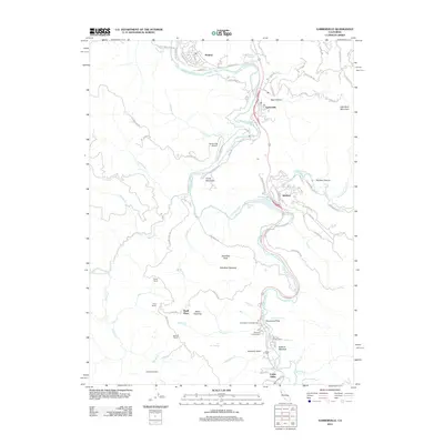
2012 Map of Garberville
USGS Topo · Published 2012About this map
The S Fork Eel River carves through the heart of this region, shaping the development of settlements like Garberville and Redway. The 2012 landscape reflects a blend of aviation infrastructure at the Garberville Airport and recreation-oriented sites such as Benbow Lake and the Hartsook Giant. Local history is deeply embedded in the rural holdings and named family sites scattered throughout the terrain, including Boyer Ranch, Beall Place, and the Nielson Ranch.
Find a feature on this map
87 named features on this map. Tap any name to fly to it.
Don’t see what you’re looking for? This feature index may not catch every label — zoom into the map to look around manually.
Map Details
Editions of this 2012 Garberville Map
This is the sole edition of this map. No revisions or reprints were ever made.
Other maps of this area

1920 · Cummings
USGS Topo · 1:62,500

1920 · Harris
USGS Topo · 1:62,500

1921 · Briceland
USGS Topo · 1:62,500

1949 · Alderpoint
USGS Topo · 1:62,500

1949 · Garberville
USGS Topo · 1:62,500

1950 · Piercy
USGS Topo · 1:62,500

1951 · Alderpoint
USGS Topo · 1:62,500

1951 · Garberville
USGS Topo · 1:62,500

1952 · Leggett
USGS Topo · 1:62,500

1957 · Ukiah
USGS Topo · 1:250,000