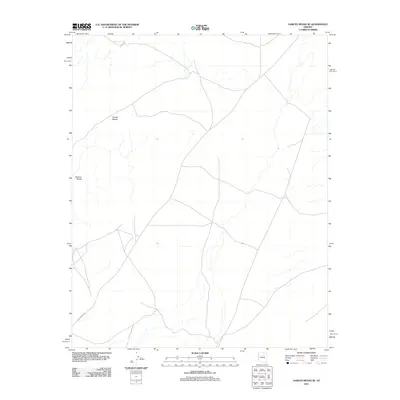
2011 Map of Garces Mesas SE
USGS Topo · Published 2011About this map
Garces Mesas and the distinctive formations of the Kachina Points dominate this high-desert landscape in northern Arizona. This 2011 survey illustrates a sparsely developed region defined by its natural drainage patterns and the historic transit corridor of the Leupp-Oraibi Rd. The road network reflects long-established routes across the plateau, connecting distant settlements through this arid terrain. For researchers, the map provides precise topography and hydrography as they existed at the start of the 2010s, showing the relationship between the elevated mesa surfaces and the intermittent watercourses that carve through the basin.
Find a feature on this map
3 named features on this map. Tap any name to fly to it.
Don’t see what you’re looking for? This feature index may not catch every label — zoom into the map to look around manually.
Map Details
Editions of this 2011 Garces Mesas SE Map
This is the sole edition of this map. No revisions or reprints were ever made.
Other maps of this area

1883 · Tusayan
USGS Topo · 1:250,000

1886 · Tusayan
USGS Topo · 1:250,000

1947 · Flagstaff
USGS Topo · 1:250,000

1954 · Flagstaff
USGS Topo · 1:250,000

1955 · Leupp
USGS Topo · 1:62,500
1957 · Winslow 2 NW
USGS Topo · 1:24,000

1958 · Flagstaff
USGS Topo · 1:250,000

1960 · Flagstaff
USGS Topo · 1:250,000

1962 · Flagstaff
USGS Topo · 1:250,000

1966 · Tovar Mesa
USGS Topo · 1:62,500