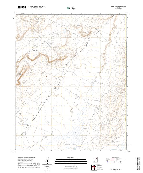
2021 Map of Garces Mesas SE
USGS Topo · Published 2021About this map
Garces Mesas rises above the arid landscape of northern Arizona, defining the physical character of this Coconino County terrain. The survey identifies high points along the western edge known as Kachina Points, overlooking a system of ephemeral drainage patterns. At lower elevations, the seasonal flow of Oraibi Wash and Polacca Wash crosses the southern and eastern portions of the map, illustrating the hydrological network that has shaped the region's geography. Connectivity across the mesa country is maintained by Indian Rte 2, which serves as the primary corridor through this open landscape. The map delineates the township and range boundaries of t26n r14e, t25n r14e, and several adjacent sections, providing a clear view of the territorial organization in this part of the Southwest.
Find a feature on this map
12 named features on this map. Tap any name to fly to it.
Don’t see what you’re looking for? This feature index may not catch every label — zoom into the map to look around manually.
Map Details
Editions of this 2021 Garces Mesas SE Map
This is the sole edition of this map. No revisions or reprints were ever made.
Other maps of this area

1883 · Tusayan
USGS Topo · 1:250,000

1886 · Tusayan
USGS Topo · 1:250,000

1947 · Flagstaff
USGS Topo · 1:250,000

1954 · Flagstaff
USGS Topo · 1:250,000

1955 · Leupp
USGS Topo · 1:62,500
1957 · Winslow 2 NW
USGS Topo · 1:24,000

1958 · Flagstaff
USGS Topo · 1:250,000

1960 · Flagstaff
USGS Topo · 1:250,000

1962 · Flagstaff
USGS Topo · 1:250,000

1966 · Tovar Mesa
USGS Topo · 1:62,500