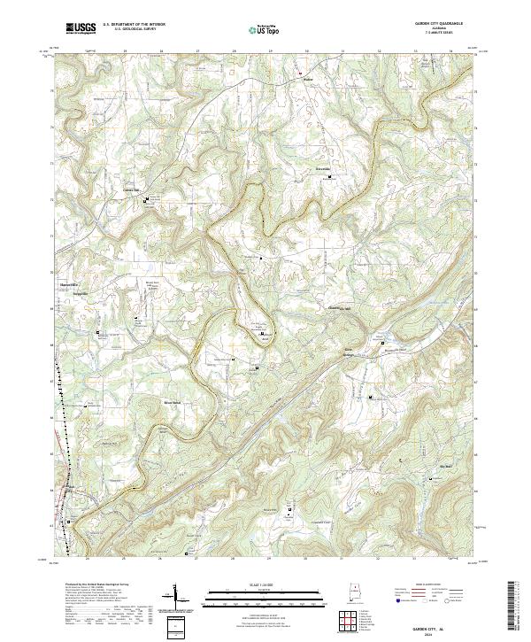
2024 Map of Garden City
USGS Topo · Published 2024About this map
Garden City and the surrounding terrain of the Cullman and Blount County line are defined by the winding course of the Mulberry Fork, which carves deep bends like Pumphouse Bend and Georgia Bend into the landscape. This recent survey captures a region where agriculture and aviation meet, featuring the New Horizon Airport and the Mount Aero Lake Farm Airport. The area is notably dense with small family and community burial grounds, such as Center Hill Cem West and the Bethlehem East Cem, which serve as vital landmarks for local genealogical research.
Find a feature on this map
161 named features on this map. Tap any name to fly to it.
Don’t see what you’re looking for? This feature index may not catch every label — zoom into the map to look around manually.
Map Details
Editions of this 2024 Garden City Map
This is the sole edition of this map. No revisions or reprints were ever made.
Other maps of this area

1888 · Cullman
USGS Topo · 1:125,000

1889 · Birmingham
USGS Topo · 1:125,000

1892 · Cullman
USGS Topo · 1:125,000

1892 · Birmingham
USGS Topo · 1:125,000

1895 · Birmingham
USGS Topo · 1:125,000

1907 · Birmingham
USGS Topo · 1:125,000

1936 · Holly Pond
USGS Topo · 1:24,000

1951 · Blount Springs
USGS Topo · 1:24,000

1953 · Birmingham
USGS Topo · 1:250,000

1956 · Birmingham
USGS Topo · 1:250,000