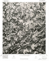
1975 Map of Garden City
USGS Topo · Published 1977About this map
The Mulberry Fork winds dramatically through the Cullman County landscape, its tight meanders defining the agricultural and settlement patterns captured in this mid-1970s orthophotoquad. This specialized imagery, produced by the Geological Survey in cooperation with the Soil Conservation Service, uses a December 1975 aerial photograph to provide a literal view of the terrain that standard topographic lines cannot fully convey. The town of Garden City sits in the lower southwest, while Hanceville and Center Hill occupy the higher ground to the north. The stark contrast between the dense woodland following the river's path and the patchwork of cleared fields on the surrounding plateaus reveals the land-use priorities of the era, offering a direct visual record of Alabama's rural farmsteads and timber tracts during this period.
Find a feature on this map
4 named features on this map. Tap any name to fly to it.
Don’t see what you’re looking for? This feature index may not catch every label — zoom into the map to look around manually.
Map Details
Editions of this 1975 Garden City Map
This is the sole edition of this map. No revisions or reprints were ever made.
Other maps of this area

1888 · Cullman
USGS Topo · 1:125,000

1889 · Birmingham
USGS Topo · 1:125,000

1892 · Cullman
USGS Topo · 1:125,000

1892 · Birmingham
USGS Topo · 1:125,000

1895 · Birmingham
USGS Topo · 1:125,000

1907 · Birmingham
USGS Topo · 1:125,000

1936 · Holly Pond
USGS Topo · 1:24,000

1951 · Blount Springs
USGS Topo · 1:24,000

1953 · Birmingham
USGS Topo · 1:250,000

1956 · Birmingham
USGS Topo · 1:250,000