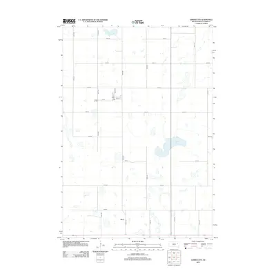
2012 Map of Garden City
USGS Topo · Published 2012About this map
The settlement of Elrod and the outskirts of Garden City define this section of Clark County in the early twenty-first century. The landscape is marked by a distinctive grid of township roads, including 431st Ave and 170th St, which navigate a terrain scattered with prairie potholes and larger water bodies like Mankey Slough. This network of section-line roads illustrates the enduring structure of the Great Plains land system, where small clusters of development remain centered around historic corridors. In the northwestern corner, the street plan near Garden City is evident with named thoroughfares such as Main St, Grover St, and Railway St. For those researching local heritage, the Garden City Cem provides a specific point of genealogical interest, while the surrounding rural landscape retains its character as a productive agricultural and wetlands environment.
Find a feature on this map
22 named features on this map. Tap any name to fly to it.
Don’t see what you’re looking for? This feature index may not catch every label — zoom into the map to look around manually.
Map Details
Editions of this 2012 Garden City Map
This is the sole edition of this map. No revisions or reprints were ever made.
Other maps of this area

1953 · Milbank
USGS Topo · 1:250,000

1953 · Watertown
USGS Topo · 1:250,000

1958 · Milbank
USGS Topo · 1:250,000

1958 · Watertown
USGS Topo · 1:250,000

1973 · Bradley
USGS Topo · 1:24,000

1973 · Wallace
USGS Topo · 1:24,000

1973 · Heggs Lake
USGS Topo · 1:24,000

1973 · Garden City
USGS Topo · 1:24,000
1973 · Henry
USGS Topo · 1:24,000

1973 · Clark South
USGS Topo · 1:24,000