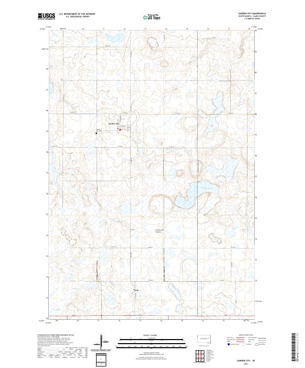
2021 Map of Garden City
USGS Topo · Published 2021About this map
Garden City and the smaller settlement of Elrod occupy this portion of the Coteau des Prairies, an expansive upland plateau characterized by numerous wetlands and depressions. The landscape is defined by the high density of prairie potholes and sloughs, including Mankey Slough and Caseys Slough, which dominate the eastern and southern portions of the map. These natural features shaped the development of the local road grid, which navigates around these water bodies. The Garden City Cem sits just west of the town center, serving as a primary point of interest for genealogists researching the families of Clark County. Transportation in the area relies on S Dakota Highway 25 and a systematic network of county roads like Co Rd 60 and Co Rd 29, which facilitate movement across this glaciated terrain.
Find a feature on this map
29 named features on this map. Tap any name to fly to it.
Don’t see what you’re looking for? This feature index may not catch every label — zoom into the map to look around manually.
Map Details
Editions of this 2021 Garden City Map
This is the sole edition of this map. No revisions or reprints were ever made.
Other maps of this area

1953 · Milbank
USGS Topo · 1:250,000

1953 · Watertown
USGS Topo · 1:250,000

1958 · Milbank
USGS Topo · 1:250,000

1958 · Watertown
USGS Topo · 1:250,000

1973 · Bradley
USGS Topo · 1:24,000

1973 · Wallace
USGS Topo · 1:24,000

1973 · Heggs Lake
USGS Topo · 1:24,000

1973 · Garden City
USGS Topo · 1:24,000
1973 · Henry
USGS Topo · 1:24,000

1973 · Clark South
USGS Topo · 1:24,000