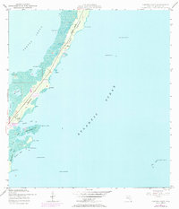
1947 Map of Garden Cove
USGS Topo · Published 1984About this map
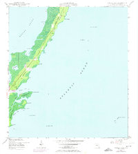
Key Largo's eastern shoreline and the surrounding turquoise waters of the Atlantic Ocean and Barnes Sound dominate this topographic study, photorevised just before the 1970s. The small settlement of Garden Cove sits as a primary point of interest along the coast, near the sheltered waters of Lake Surprise and Lake Simmons. The map captures a transition period for the northern Florida Keys, where the limestone ridges of the Basin Hills meet intricate mangrove coastlines and tidal inlets like Rattlesnake Creek. Navigation aids are a critical element of this coastal record, ranging from the Key Largo Beacon No 29 out in the Atlantic to the lighthouse at Basin Hill Lt No 31. To the south, the map details the rugged geometry of El Radabob Key and the shoals near The Elbow, providing essential detail for those studying the maritime history and land development patterns of Monroe County during the mid-twentieth century.
Find a feature on this map
40 named features on this map. Tap any name to fly to it.
Don’t see what you’re looking for? This feature index may not catch every label — zoom into the map to look around manually.
Map Details
Editions of this 1947 Garden Cove Map
3 editions found
Other maps of this area

1947 · Garden Cove
USGS Topo · 1:24,000

1947 · Rock Harbor
USGS Topo · 1:24,000

1947 · Blackwater Sound
USGS Topo · 1:24,000

1949 · Blackwater Sound
USGS Topo · 1:24,000

1949 · Rock Harbor
USGS Topo · 1:24,000

1949 · Garden Cove
USGS Topo · 1:24,000

1949 · Card Sound
USGS Topo · 1:24,000

1949 · Pacific Reef
USGS Topo · 1:24,000

1950 · Glades
USGS Topo · 1:24,000

1956 · Card Sound
USGS Topo · 1:24,000