
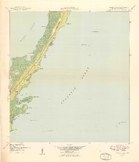
1949 Map of Garden Cove
USGS Topo · Published 1949About this map
Key Largo's eastern coastline and the surrounding waters of the Florida Straits are captured here in the late 1940s, shortly after aerial photography revolutionized coastal mapping. The narrow spine of the key is dominated by the Basin Hills and small, scattered settlements such as Knowlson, White, and Baker. Water access was clearly the primary driver of development, with several named points and bights like Cove Point and Whitmore Bight marking the interface between the limestone islands and the Atlantic Ocean.
Find a feature on this map
63 named features on this map. Tap any name to fly to it.
Don’t see what you’re looking for? This feature index may not catch every label — zoom into the map to look around manually.
Map Details
Editions of this 1949 Garden Cove Map
2 editions found
Other maps of this area

1947 · Garden Cove
USGS Topo · 1:24,000

1947 · Rock Harbor
USGS Topo · 1:24,000

1947 · Blackwater Sound
USGS Topo · 1:24,000

1949 · Blackwater Sound
USGS Topo · 1:24,000

1949 · Rock Harbor
USGS Topo · 1:24,000

1949 · Card Sound
USGS Topo · 1:24,000

1949 · Pacific Reef
USGS Topo · 1:24,000

1950 · Glades
USGS Topo · 1:24,000

1956 · Card Sound
USGS Topo · 1:24,000
1956 · Pacific Reef
USGS Topo · 1:24,000